Creating SHAPE File in NetCAD

The video below, prepared by Survey Engineer Hüseyin Cem İNCE; The process of exporting areal objects in a file with NetCAD .ncz extension as .shp file without data loss is explained. Since ArcGIS and similar software generally do not recognize files with .ncz extensions, users can view files with .ncz extensions after converting them to different formats (such as .dwg). However, data loss and various problems are encountered frequently in such processes. For this reason, in order to avoid data loss, how to convert the .ncz file to .shp file, which has become the standard file format for many software, is discussed in detail in the video below. Once again, I thank Hüseyin Cem İnce for his sharing.

I hope the prepared content will be useful.

Share This

Parcel Area Infringement Calculation

Parcel Area Infringement Calculation

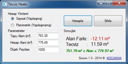
If you are doing a cadastral survey in Turkey and you need to make a parcel area infringement calculation for the area account of the parcels, you can use the Tecviz Hesabı software prepared for this. Click here to download the application.

Share This

Quantum GIS, Free and Open Source GIS All Over The World

I have been very interested in QGIS with the short name Quantum GIS, which I have known about its existence for several years. Based on the idea that it would be useful to share the information I gained from this close interest, and because there are not many significant resources in Turkish about the software, I decided to start the series of articles on the use of QGIS with this introductory article.

Continue reading Quantum GIS, Free and Open Source GIS All Over The World

Share This

Datum Transformation from WGS84 to ED50 with Cartesian Coordinates

7-parameter Helmert transformations

A reader recently; He sent an e-mail saying that he wanted to perform a coordinate transformation with cartesian coordinates between his WGS84 Datum and his ED50 Datum, but had no idea what the units of the transformation parameters would be. Since I do not have very detailed information on the subject, after doing a research and obtaining detailed information, I prepared a small application of the conversion process in the Excel program by using the coordinate values ​​obtained by converting a point to the ED50 Datum of this point with the Cartesian coordinates given in the WGS84 Datum of a point sent by my reader. I used the transformation parameters defined by HGK as the transformation parameters, and the values ​​I obtained and the desired values ​​matched exactly.

In the attached file, there is an explanatory flow chart of how the process is done and the solution of the process in Excel. I hope it will be useful in advance.

You can download the document here.

Share This