
WKT (Well-Known Text) and WKID (Well-Known ID) can be described as two ways of defining any coordinate system. By using WKT or WKID definitions, we can easily and correctly ensure coordinate system consistency in our projects.
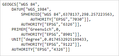
WKT is a string that defines all the necessary parameters of a coordinate system. To see the WKT of any coordinate system, you can save its projection file (.prj) and open it in a text editor.
WKID is a unique number assigned to a coordinate system. In short, every WKT has a WKID number, which makes it possible to reach the coordinate system you want quickly and easily.
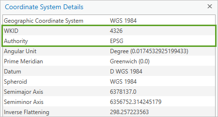
Although WKT and WKID definitions are made by both Esri and the EPSG (European Petroleum Survey Group), the numbers do not overlap. Therefore, you don’t need to worry about which authority defined the ID.
Note: For detailed information about EPSG, see: https://www.hakankocaman.com/what-is-epsg
Source: https://www.esri.com/arcgis-blog/products/arcgis-pro/mapping/coordinate-systems-difference/
Posted: by Hakan KOCAMAN
