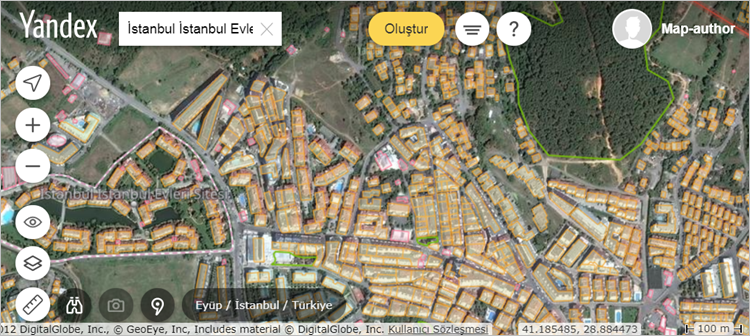
Yandex Map Editor Launched in Turkey

You can now edit the data in the Yandex Map service, which many of us use in our daily lives. This way, you can add to the map or correct geographic objects (roads, buildings, addresses, shopping centres, etc.) that are missing from Yandex Map or need correcting. All you need to do is go to https://mapeditor.yandex.com and log in with your Yandex account.


Continue reading Yandex Map Editor Launched in Turkey

Share This

New BÖHHBÜY (Large-Scale Map Regulation) Published

The new “Regulation on the Production of Large-Scale Maps and Map Information (BÖHHBÜY)” entered into force upon its publication in the Official Gazette dated 26 June 2018, numbered 30460 (Duplicate). It contains important changes regarding geodetic and photogrammetric work, above all the use of the TUSAGA-Aktif system, the establishment of GNSS networks and the use of digital aerial cameras.

For the regulation and its annexes, click here.

Share This

What is EPSG? Coordinate Reference System Codes

EPSG, which stands for The European Petroleum Survey Group, was founded in 1886 and consists of expert researchers, cartographers and geodesers of European oil companies. This group meets twice a year to discuss and coordinate issues related to the oil industry. In addition, EPSG protects geodetic parameters (datum and projection definitions, ellipsoid parameters, etc.) in a relational database by a geodetic working group.

Continue reading What is EPSG? Coordinate Reference System Codes

Share This

The World’s First Dual-Frequency GNSS Smartphone

In my article titled “GNSS and Mobile Technologies”, which I wrote for the 99th issue of the HKMO Map Bulletin published a few months ago (you can read the blog post on the subject here or the article in the Map Bulletin here), I mentioned that innovations were emerging that would enable sensors to track more GNSS signals in order to directly increase the positioning accuracy of mobile devices, and that, judging by the pace of this development, it might soon be possible to obtain centimetre-accurate position information with just our mobile device, without needing an additional receiver. Yes, and not much time has passed before the first examples have already started to appear on the market.

Continue reading The World’s First Dual-Frequency GNSS Smartphone

Share This

Esri Turkey Blog Launched

imageFor many years I had been following the latest developments about Esri and ArcGIS on the blog at https://blogs.esri.com/esri/arcgis/. Recently I noticed that Esri Turkey has now started publishing a Turkish-language blog at http://blog.esriturkey.com.tr/. Looking at the blog content published by Esri Turkey, you can see that it contains very high-quality posts. I hope the number of posts keeps growing in the future and that it becomes a high-quality resource for those who want to follow the latest developments about Esri and ArcGIS in Turkish.

Share This